Official maps of the multi-hazard study — IOM Burundi
Completion requirements
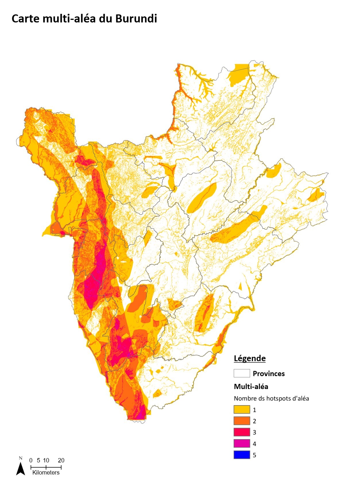
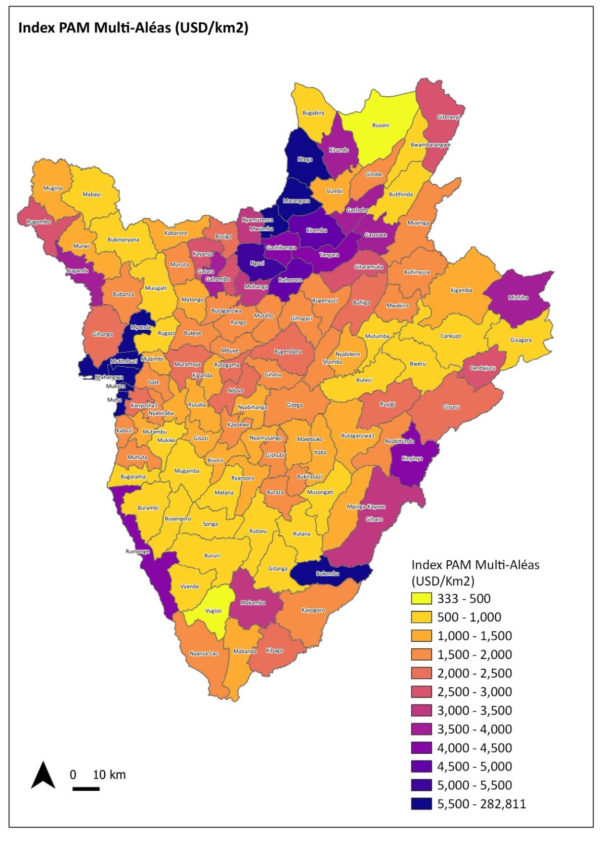
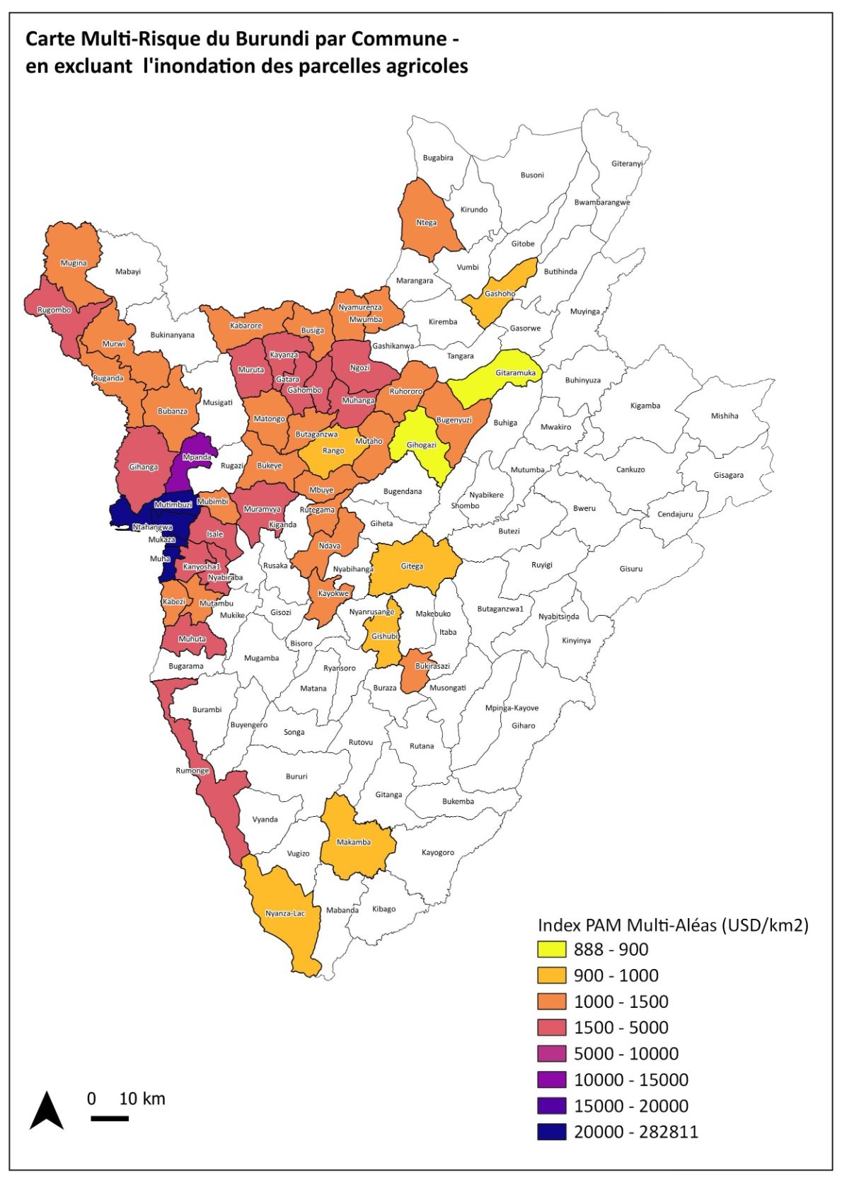
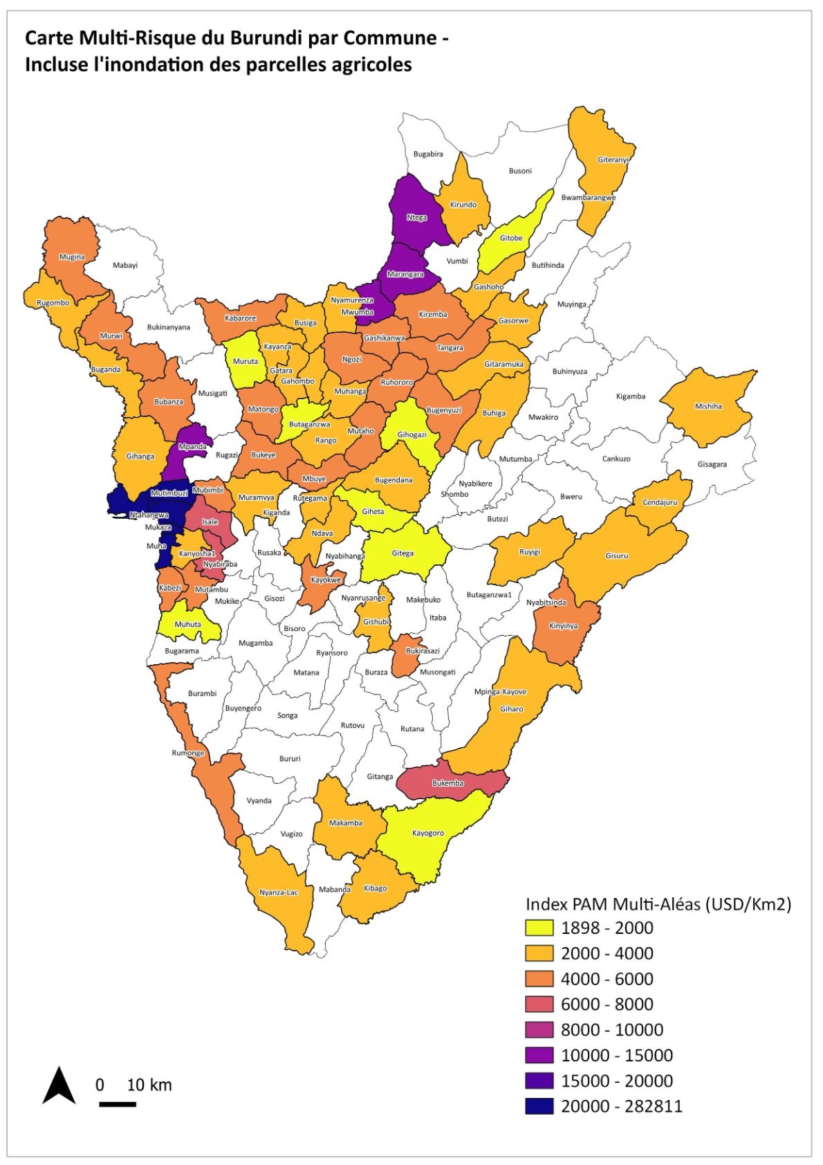
Four maps reproduced, for educational and non-commercial purposes, from the national risk platform: multi-hazard map of Burundi, multi-risk map of all communes, and the two maps of the 50 priority communes (all hazards, and excluding flooding of agricultural plots). Source: IOM Burundi, Multi-hazard risk assessment and mapping in Burundi (2020-2022), IDOM consortium, funded by the European Union. These maps remain the property of their authors; any reuse must cite the source.